Online Historical Maps of Harford County

Over the past several years there has been an enormous increase in the number of historical maps that are available online.  These digital collections are a great aid for those of us seeking to understand the past, whether it is for a scholarly investigation, local history study, or genealogy project. While the maps, many centuries old, have been available in special collections repositories around the nation, the access was limited as trips to widely scattered archives created obstacles for most researchers.

Recently I needed to examine old drawings from Harford County, and I was able to easily access e-published renderings from a number of universities, historical societies, and libraries around the world.

There are a few helpful starting points, when accessing these primary sources.  One of the best is Old Maps Online, an easy-to-use web portal to historical maps in libraries around the globe.  It allows the user to search across a number of extensive collections, via a geographical search interface.  Another strong one is the Library of Congress.  The products can be downloaded and the scans, which are of high quality, can be magnified, in most instances.  Some of repositories require you to register to get full access.

These and other research e-resources are revolutionizing the way we conduct historical research and are invaluable for those working in the past.  Here are some sites for locating Harford County Maps online, as well as any other place you are examining.

  • Searchable on Old Maps Online, the David Rumsey Map Collection has Simon J. Martenet’s Map of Harford County, along with dozens of other digital products.
  • Old Maps Online also has Brown University Library’s C. P. Hauducoeur’s engraving of the head of the Chesapeake and Susquehanna River.  Of course, many more are found via this web portal.
  • The Library of Congress has L. W. Herrick’s Map of Harford County from 1858 and Martenet’s 1878 Map.  It also has T.M. Fowler’s 1907 birds-eye-view of Havre de Grace.
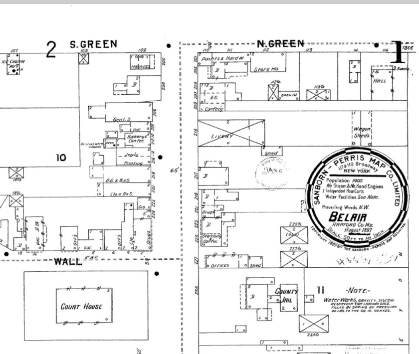
  • The Enoch Pratt Library has a subscription to the Sanborn Fire Insurance Maps. From the 1880s until about World War II, the cartographers for this company visited towns regularly to update drawings and produce sketches at a detailed scale of 1-inch to fifty feet.  With these a researcher is able to observe the changes that took place with a dwelling or a community over generations.  You need a Baltimore City Library card to access the database online.
  • Here is a link to a union catalog, an index, of all the Sanborn Maps published for Maryland.

Check these resources out the next time you are working on a project and need Harford County Maps.  Regardless of where your inquiry takes you you will find many other maps of interest as you start searching these and other databases.
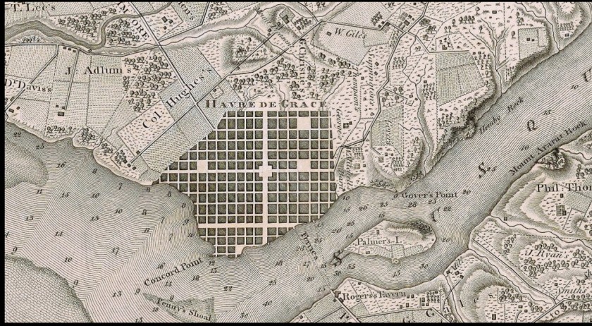
A map of the head of Chesapeake Bay and Susquehanna River  by C. P. Hauducoeur; Source:  The John Carter Brown Library at Brown University, via:  Old Maps Online
A portion of the map of the head of Chesapeake Bay and Susquehanna River by C. P. Hauducoeur; Source: The John Carter Brown Library at Brown University, via: Old Maps Online
Sanborn Fire Insurance Map of Bel Air, 1897; Source Enoch Pratt Library
Part of the Sanborn Fire Insurance Map of Bel Air, 1897; Source Enoch Pratt Library
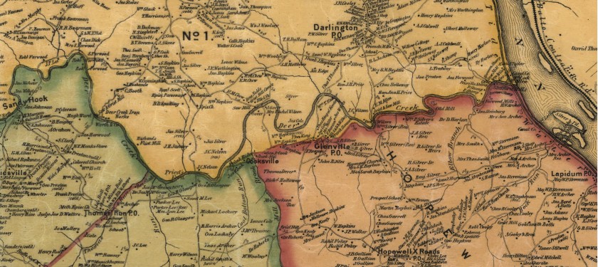
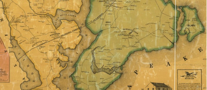
Harford County Maps, 1858.
A portion of the map of Harford Co., Maryland, 1858. Entirely from original surveys by L.W. Herrick; Source: Library of Congress
Martenet's Map of Harford County, Maryland, 1878:  Source:  Library of Congress
A part of Martenet’s Map of Harford County, Maryland, 1878: Source: Library of Congress

Serving as Scholar for ALA, NEH Program – “Let’s Talk About It: Making Sense of the American Civil War”

Samuel Harris of Brick Meeting House on Maryland's Eastern Shore, a young soldier in the Union Army during the Civil War.  He was in Co. E Purnell Legion.
Samuel Harris of Brick Meeting House on Maryland’s Eastern Shore, a young soldier in the Union Army during the Civil War. He was in Co. E Purnell Legion.

Let’s Talk About It:  Making Sense of the American Civil War is a National Endowment for the Humanities (NEH) and American Library Association (ALA) reading and discussion program.  Participants in this series read a common series of books, using the carefully selected titles to spark exploration, reflection, conversation and greater understanding of this pivotal period, throughout the sesquicentennial of the conflict.

The Wicomico Public Library, one of about 150 sites to host the ALA and NEH program, is sponsoring the national reading and discussion program on the Lower Eastern Shore.  Throughout the five-part discussion series, readers consider the legacy of the Civil War and emancipation through historical and contemporary literature as they discuss pivotal events in the selected works.

I am looking forward to serving as the scholar for the discussions and readings.  We will consider speeches, diaries, memoirs, and short stories, representing a broad range of perspectives from the era.

Interest in History of the Mason Dixon Line Grows as 250th Anniversary Nears

On the eve of the 250 anniversary of the Mason Dixon Line I have been doing a number of talks about the history of this famous boundary.  To end a boundary dispute between the Penns and Calvert (the proprietors of the British colonies of Maryland and Pennsylvania) it was surveyed in the 1760s.  Delaware was part of Pennsylvania at that time.

While speaking to a group at the Wicomico County Public Library yesterday and sketching out the details about the work commissioned by the Penns and Calverts, one gentleman had some stories of his own to share.  His family, some of the earliest European settlers in the region, own property on both sides of the line.  In an old trunk in the attic he located detailed surveys from the era showing the property boundaries and topographical features along the transpeninsular boundary.  It was a fascinating historical document and we had a long enjoyable talk about some of the manuscripts he possessed, as well as some the markers and points along the 325-miler border.

Here are a few modern photos of the famous line that got its start in 1763.  Next year, I am scheduled to do a number of additional talks about the line that grew to have representations far beyond that associated with a boundary dispute.

Post Road crosses Mason Dixon Line
The Mason Dixon Line on the Old Baltimore Pike between Newark and Elkton.
Mason Dixon Line near Unions Mills MD
Route 97 between Littlestown, PA and Union Mills, MD

.Mason Dixon Line near Littlestown PA

Historic Digital Maps of Maryland and Delaware Are Just a Click Away on New Website

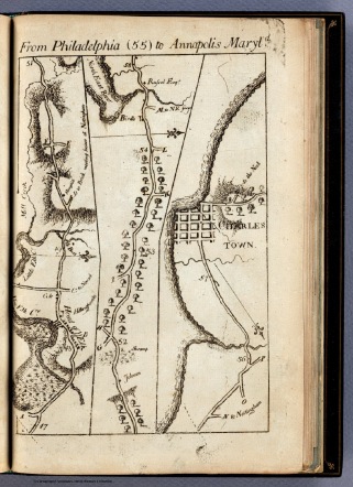
Map of part of road from Philadelphia to Annapolis published in 1789 by Christopher Colles. Sources: David Rumsey Collection

Digital resources available to researchers have grown enormously in recent years, making the work of researchers much easier as sought after data is often just a few clicks away. Maps are one of those areas of growth as they’ve been scanned by special collections institutions, making them virtually available on demand.

I was recently made aware of a valuable new repository for researchers, Old Maps Online. This free resource serves an easy to use portal to historical maps in libraries around the world, allowing users to search for online digital historical maps across numerous different collections via a geographical search engine. It’s contributors include the New York Public Library, the David Rumsey Collection, the British Library and many more.

I’ve been using it for a few months now to access material to help with classroom lectures and public talks. It’s making items that are stored deeply away in distant, special collections institutions easily available.

In addition, you will find a number of other links to map resources on my links research page. 

Beers Atlas of Delaware, Newark Page, 1868: Source: Rumsey Map Collection