A Research Resource Shows Family Name Distribution Patterns

11-27-2013 10-33-37 PM

An interesting page on Ancestry.com presents aggregated statistical surname data from an array of standard primary genealogical research materials. 

Drawing on sources such as census schedules, the Social Security Index, Civil War Enlistment papers, immigration records, and more, users query the searchable databases for surnames. 

In graphical and tabular formats, the inquiry yields information on where families lived in the U. S. and U.K., average life expectancy, occupations, service in the Civil War, and much more.  Family history data of this type, particularly the origin and distribution patterns over time, may offer clues to the geographical location of families and is interesting to family historians.

Distribution of PIckel family name in the 1840 census.

Here is an example for the surname Pickel.  In the 1840 census, families with that name were concentrated in Pennsylvania, but there were clusters in New York, Ohio, and Indiana.  In subsequent decades (1880 and 1920), the family spreads out across the growing nation, but a strong concentration remains in the original areas.  When the Civil War split the nation, the Ancestry records identify 82 Pickels serving the Union while 28 fought with the Confederates.

Lots of information is easily aggregated here so check it out.  The aggregated statistical data can give some idea of where to focus research and is interesting.  Of course Ancestry hopes the curious types surfing over that way subscribe in order to view the detailed data.

Click here to go to the page.

11-27-2013 10-43-07 PM

The Flickr Commons Has Many Old Photographs and Postcards

The ferry running between Pennsville, NJ and New Castle DE. Source: Boston Public Library, Flickr Commons

As a result of developing research materials for centuries many of the nation’s largest public libraries have vast collections of photographs and postcards from earlier times.  These items, which are helpful to those digging into the past, have always been available, safely preserved and stored away for visiting patrons.  But now access is greatly enhanced as many of these institutions implement online sharing platforms that support the organization’s mission by increasing access for education, research, and personal enrichment.

The Boston Public Library (BPL), following the example of the Library of Congress, is one of the institutions that has embraced this approach.  It has about 86,000 images on the Commons.  BPL’s photostream is organized into collections and sets. clustered by major topic and state.  It has many historical treasures, including posters, postcards, labels, sheet music, trade cards, and much more.   There are 189 Delaware and 380 Maryland postcards, for example.

The goal of the Flickr Commons is to increase access to publicly held photograph collections and provide a way for the general public to contribute information and knowledge.

Check it out.  You will find images there that will catch your interest as more institutions find innovative ways to share holdings found in the “world’s public photography archives.”  Beyond making the images available on the Internet, visitors are invited to contribute to the public knowledge by adding tags and leaving comments.

———————–

Flickr, Google and Others are Out to Catalog the World’s Public Photo Archives.

The blog Indicommons has a lot of additional information about the the Flickr approach.  Check it out for details, but here are some points the site makes

  • “The Commons . . . expands creative freedom and enriches culture by pushing cultural media outside of the confines and limitation of physical media and by making this media available . . .”
  • “Participating institutions benefit from greater exposure of its collections through Flickr’s high profile and it’s large user base.”
  • “The Commons also allows participating institutions to harness the limitless power of the crowd to mine otherwise inaccessible data.”
  • “The Commons provides educators and their students a wealth of historical imagery and information from around the world. It also allows educators and their students to participate in the historical research and tagging.”

A Dover, DE postcard from the Boston Library

The Boston Library’s Flicker Commons


Milford Public LIbrary Digitizes Old Delaware Newspaper

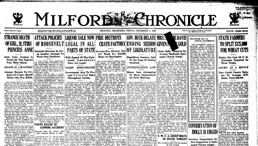
The Milford Public Library has greatly increased the usability of an important research resource by digitizing its collection of local newspapers.   The new products, replacing the old, original microfilm, are not available on the web, so e-copies must be used on a computer workstation at the library.

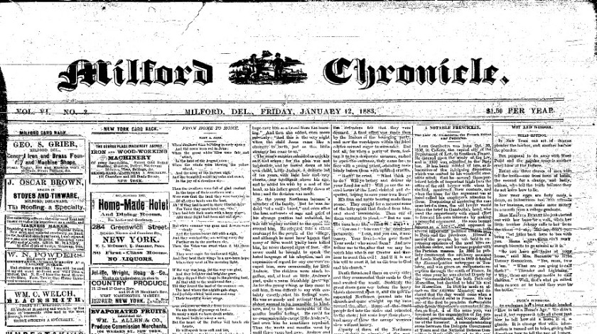
The town on the line between Kent and Sussex counties had a strong Delaware product, the weekly Milford Chronicle.  It started publishing in 1883 and each week the editors’ packed the pages with fresh, insightful area news from the town and nearby neighborhoods.  When investigating downstate subjects, the strength and quality of this serial usually makes it one to check out for the pages are crammed with original, local news.   The library has carried the run of the Chronicle forward to present times.  A paper of more recent origin, the Beacon was also digitized.

These professionally scanned, high-quality images are valuable and join a growing body of digitized Delaware newspapers.  Thank you Milford Public Library.

Milford Chronicle
The Milford Chronicle at the Milford Public Library

The Milford Chronicle
The Milford Chronicle has been digitized by the Milford Public Library

Large Collection of Online Historic Delaware Maps Help Researchers

Part of the 1859 Map of Kent County Delaware (French), showing Leipsic.  Source:  Library of Congress
Part of the 1859 Map of Kent County Delaware (French), showing Leipsic. Source: Library of Congress

Over the past several years there has been an enormous increase in the number of historical maps that are available online.  These digital, on-demand collections are a great aid for those seeking to understand the past, whether it is for a scholarly investigation, local history study, or genealogy project. While the


Part of the 1859 map of Kent County Delaware showing Smyrna and part of Camden.  Source:  Library of Congress
Part of the 1859 map of Kent County Delaware showing Smyrna and part of Camden. Source: Library of Congress

maps, many centuries old, have always been available in special collections repositories around the nation, access was limited as trips to widely scattered archives and access rules created obstacles for some researchers.

Here are a couple of general starting points.  One of the best is  Old Maps Online, an easy-to-use web portal to historical maps in libraries around the globe.  It allows users to search across a number of collections, via a user friendly geographical search interface.  Another strong one is the Library of Congress.  The products can be downloaded and the scans, which are of high quality, can be magnified, in most instances.  Some of repositories require you to register to get full free access.

These and other research e-resources are revolutionizing the way we conduct historical research and are invaluable for those working in the past.  Here are some specific online Delaware resources, which you should find helpful.

  • The Library of Congress has the J. H. French Map of Kent County Delaware (1859), It can be downloaded in a large format in order to magnify the product.  There is also the Birds-Eye View of Wilmington Delaware (1874) in addition to over 30 more products.
  • Old Maps Online provides a portal to the full Beer Atlas of 1868, a most valuable product for researchers.  Here is the link to Georgetown Hundred but the other plates are there too.  
  • The USGS Historical Topographic Map Collection provides acce3ss to more than 193,000 topograph maps published by the USGS since the inception of the national mapping program in 1884.  It includes the Delaware products.  Also here is another free source for these maps.  
  • Historic aerial maps of Delaware, beginning in the 1930s and running to the present, are available online through a service provided by the Delaware Geological Service’s Delaware DataMil (Data Mapping and Integration Laboratory).  This virtual service allows researchers to easily acquire detailed visual representations showing the nature of development on parcels at specific points in time.
  • On one of the local heritage weblogs we follow, the Mill Creek Hundred History Blog, we found out about some great e-cartographic content at the “New Castle Community History and Archaeology Program” site.  The publisher of that site, Jim Meeks, has made some great produts available, including a zoomable copy of the Rea & Price Map of New Castle County (1849).

You will also find a collection of historic First State Maps at the Delaware Public Archives, as well as Official Highway Maps provided by DelDOT.  The first e-product there was published in 1906 and the Official Highway Maps start in 1920.

Check these site out the next time you are working on a Delaware project, regardless of where your inquiry takes you around the State.  You will find many other maps of interest once you start searching these and other databases and with each passing year more of these resources are open sourced, greatly expanding efficiencies for those studying the past.

A plate from the Pomery & Beers Atlas of Delaware (1868) showing White Clay Creek and Newark.
A plate from the Pomery & Beers Atlas of Delaware (1868) showing White Clay Creek and Newark. Source: David Rumsey Collection via oldmapsoline.org